Open photo GPS location in Apple Maps using ruby
Dr. Drang posted a lengthy article and script to open a given photo’s EXIF GPS location in Apple Maps. He’s using python and a library called “PIL”. I liked the idea but couldn’t, no matter what I tried, get the damn thing to install and what is python anyway? I like ruby! I’m sure there’s an easier way?
Turns out there was.
The rubygem exifr reads EXIF data like a champ, so let’s get it:
$ sudo /usr/bin/gem install exifr
I’m using the absolute path to gem, because we want to end up using this as a system service, and system services use system ruby.
Now, here’s the script. Save it as something like ~/bin/map.rb:
#!/usr/bin/env ruby
begin
  require 'exifr'
rescue LoadError
  require 'rubygems'
  require 'exifr'
end

usage = <<-USAGE
usage: map.rb IMAGE_PATH
USAGE

path = ARGV.shift

if path.nil?
  puts usage
  exit(0)
end

exif = EXIFR::JPEG.new(path)
if coords = exif.gps
  system "open 'http://maps.apple.com/?q=#{coords.latitude},#{coords.longitude}'"
else
  puts "No GPS data for #{path}"
end
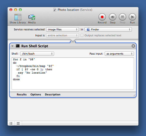
Remember to chmod +x it and call it like the Doctor does in a service like this, substituting the path to where you saved the script: